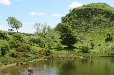
Duncarnock Fort (The Craigie)
Enjoy a historical walk through Neilston and Barrhead which goes back to prehistoric times

A historical walk through Neilston and Barrhead, which visits Duncarnock (known locally as The Craigie). Visible remains of an iron-age fort lie near the 204 metre summit and its history goes
back to prehistoric times.
Mary, Queen of Scots was rumoured to enjoy the view from the top. Wonderful birdlife can often be spotted along the route. Please note the north and west sides of the Craigie are fairly steep.
There is an operational farm in the area and walkers are requested to be respectful of this and the farm workers whilst exploring the area.
About the route
Route 1
| Distance | 4 miles - out and back |
| Time | 2.5 hours/3 hours |
| Start/Finish | Neilston train station |
| Grade | Easy to moderate |
| Local Shops | Main Street, Neilston |
Route 2
| Distance | 2.5 miles - out and back |
| Time | 2.5 hours/3 hours |
| Start/Finish | Balgraystone Road car park |
| Grade | Easy to moderate |
| Local Shops | Barrhead |
Download a map of the route with directions (PDF, 1 MB)
Watch a video of the route
Directions
Route 1
- From Neilston train station turn right, then left into Kirkton Road. Pass the field and continue along the single-track road. The road bears left past Loanfoot Farm to reach the junction with Springhill Road.
- Cross Springhill Road, go through a gate into a field. Walk along a track with a fence line on your left hand side. Where the fence line ends, continue walking down the field towards the meeting point of two areas of woodland. Go through a gate and down to a fisherman's bothy beside Glanderston Dam, with The Craigie now visible ahead.
- Turn left and walk along a track. Turn right through a small gate, follow a grass embankment above the dam. At the end of the embankment go over a small bridge and gate, walk alongside a row of trees keeping them on the right. After the last tree bear left towards a wooden stile at a wall. Cross the stile and turn left following an uneven path below The Craigie. As the path begins to climb turn right at a fork and climb to reach the summit.
- Follow the path back down to Glanderston Dam go through the gate onto a farm track. Turn left, walk along the track then bear left onto Glanderston Road. Continue alongside woodland then turn right onto Springhill Road to reach Five-Ways junction.
- Turn left onto Springfield Road (Johnny Blue's Well Road), go round a tight bend, and continue into Neilston at Sykes Terrace. Walk past a row of houses to traffic lights. Follow the narrow road across a bridge to reach a roundabout. Turn right onto Kirktonfield Road, follow this to Neilston Main Street, turn left, pass the Leisure Centre and Neilston Library, turn left onto High Street and walk back to the train station.
Route 2
From Balgraystone Road car park walk up Balgraystone Road until you reach Glanderston Road. Turn right and follow the road down past a farm and a bridge over the Aurs Burn. After a short, steep incline the road veers left. Just before Glanderston Woods take the farm track on the left go through the smaller gate to Glanderston Dam and follow the route to the Craigie. Return by the same route.

