Dams to Darnley Country Park - Reservoir tour
Please note parts of these walks are currently inaccessible until the completion of the Aurs Road improvement project.

Further information on the Aurs Road improvement project.
This scenic route travels along waymarked tracks through the Country Park and alongside the reservoirs of Balgray, Ryat Linn and Waulkmill Glen.
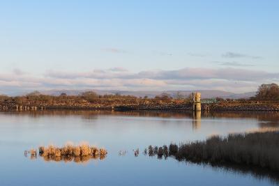
Located between Darnley, Barrhead and Newton Mearns, Dams to Darnley Country Park provides a range of walking and cycling routes to suit different abilities with stunning views of the Barrhead dams and over to the Campsie Fells.
About the route
Route 1
| Distance | 7 miles - out and back |
| Time | walk: 2.5 hours cycle: 1 hour |
| Start/Finish | Balgraystone car park |
| Grade | Easy to moderate |
| Local Shops | Barrhead/Newton Mearns |
Route 2
| Distance | 2.5 miles - out and back |
| Time | 30 minutes |
| Start/Finish | Balgraystone Road car park, Barrhead |
| Grade | Easy |
| Local Shops | Barrhead/Newton Mearns |
Download a map of the route 1 with directions (PDF, 1 MB)
Download a map of the route 2 with directions (PDF, 316 KB)
Watch a video of the route
Directions
Route 1
1.25 miles
- Start from the car park on Balgraystone Road by turning left onto a path signposted for Balgray Reservoir. Follow the path anti-clockwise around Balgray Reservoir along a firm track and over three bridges, for just over one mile.
- Carefully cross Aurs Road, then follow the path with the Brock Burn
- to your right until you reach the waterfall.
- Turn right following the signpost for Waulkmill Glen Reservoir. Continue along this track, with Ryat Linn Reservoir on your right,
- for around a quarter of a mile.
- Bear left, descend underneath the railway viaduct and continue along the path. Waulkmill Glen Reservoir is on the right and Littleton Reservoir to the left, until you reach a fork.
- Waulkmill Glen Reservoir draw off tower to your right is a Grade A listed building. On a clear day you get the best view within the country park from the bridge over the Brock Burn to your left. You can see Barrhead below and the Arrochar Alps in the far distance.
2 miles
- Take the left fork signposted for Waulkmill Glen and go down a solid track steeply into the woodland.
- Follow the track to reach a barrier, go around this and pass by a cottage.
- Look out for the old ruin on the left, it's thought that this was associated with the Darnley Bleachfields. From here a quiet single-track road leads out of the woodland (watch out for occasional traffic from here to Darnley as this section is open to vehicles) and travels through peaceful countryside.
- A gentle slope provides a great run, continuing for 1-mile, to reach the outskirts of Darnley.
- A final flat stage makes its way along a slightly busier section of road, passing some houses, to reach the A726.
- Carefully cross the A726 at traffic lights to reach the Darnley Sycamore.
3 miles
- To return to Balgraystone Road simply follow the same route taking into account a short, steep climb to reach Waulkmill Glen and Balgray reservoirs.
Route 2
- Start from the car park on Balgraystone Road by turning left onto a path signposted for Balgray Reservoir. Alternatively you can access the start of the route from Springfield Road (Barrhead), along the Balgraystone Road path opposite St Luke's School.
- Follow the path anti-clockwise around Balgray Reservoir along a firm track and over 3 bridges, for just over 1 mile.
- As you approach Aurs Road, the draw off tower at the northern side of the reservoir, which is a Grade B listed building, is particularly prominent.
- Return following the same route.
- The path continues on the other side of Aurs Road if you want to explore the rest of the Barrhead dams.
Please take extra care if you are crossing Aurs Road as it can be very busy with traffic.

